Mapping Feature
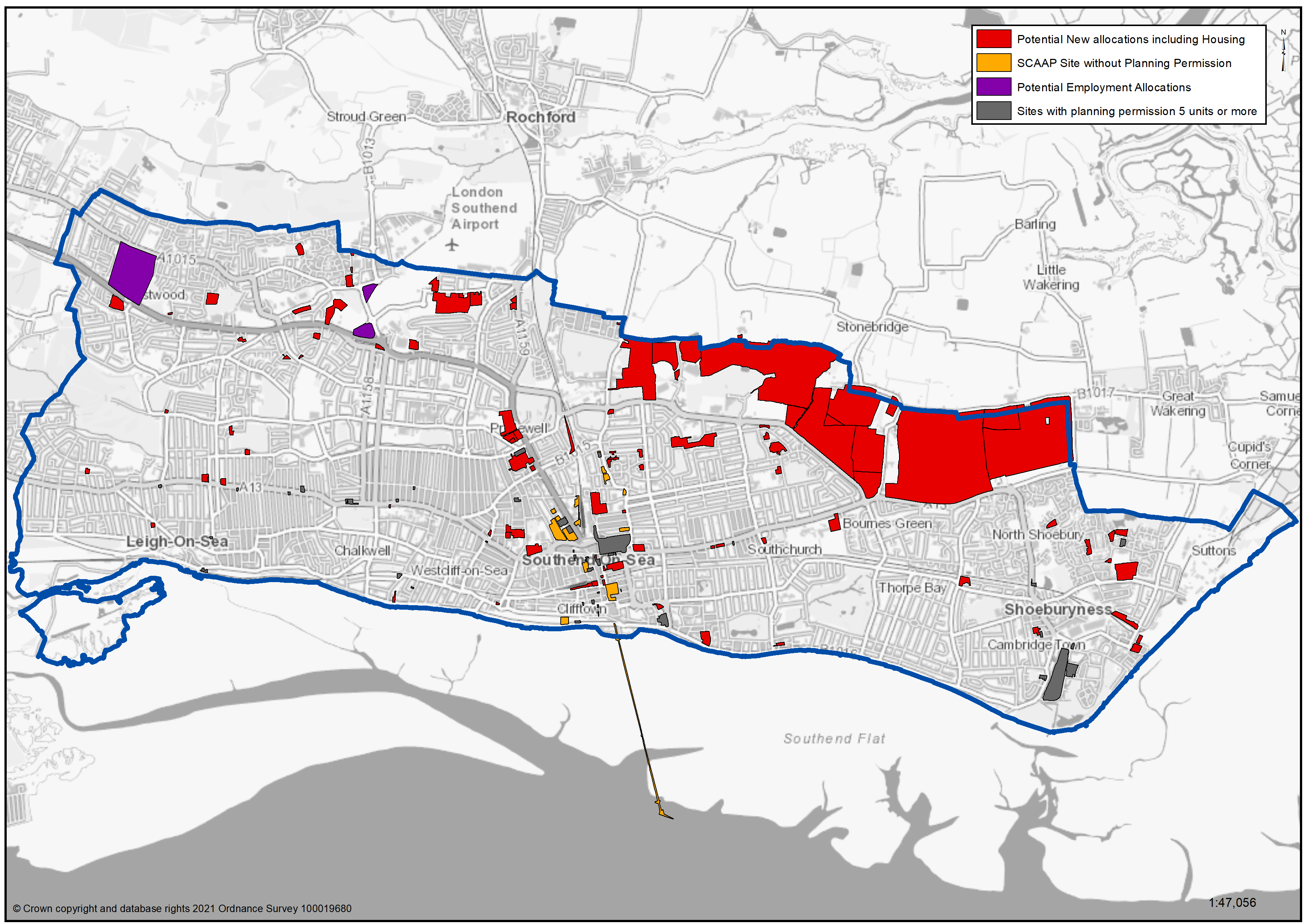
To view our mapping feature (Potential Residential and Employment Sites): Southend-on-Sea Borough Council – Local Plan: Map 1 Borough wide map with neighbourhoods and specific housing and employment allocations (opus4.co.uk)
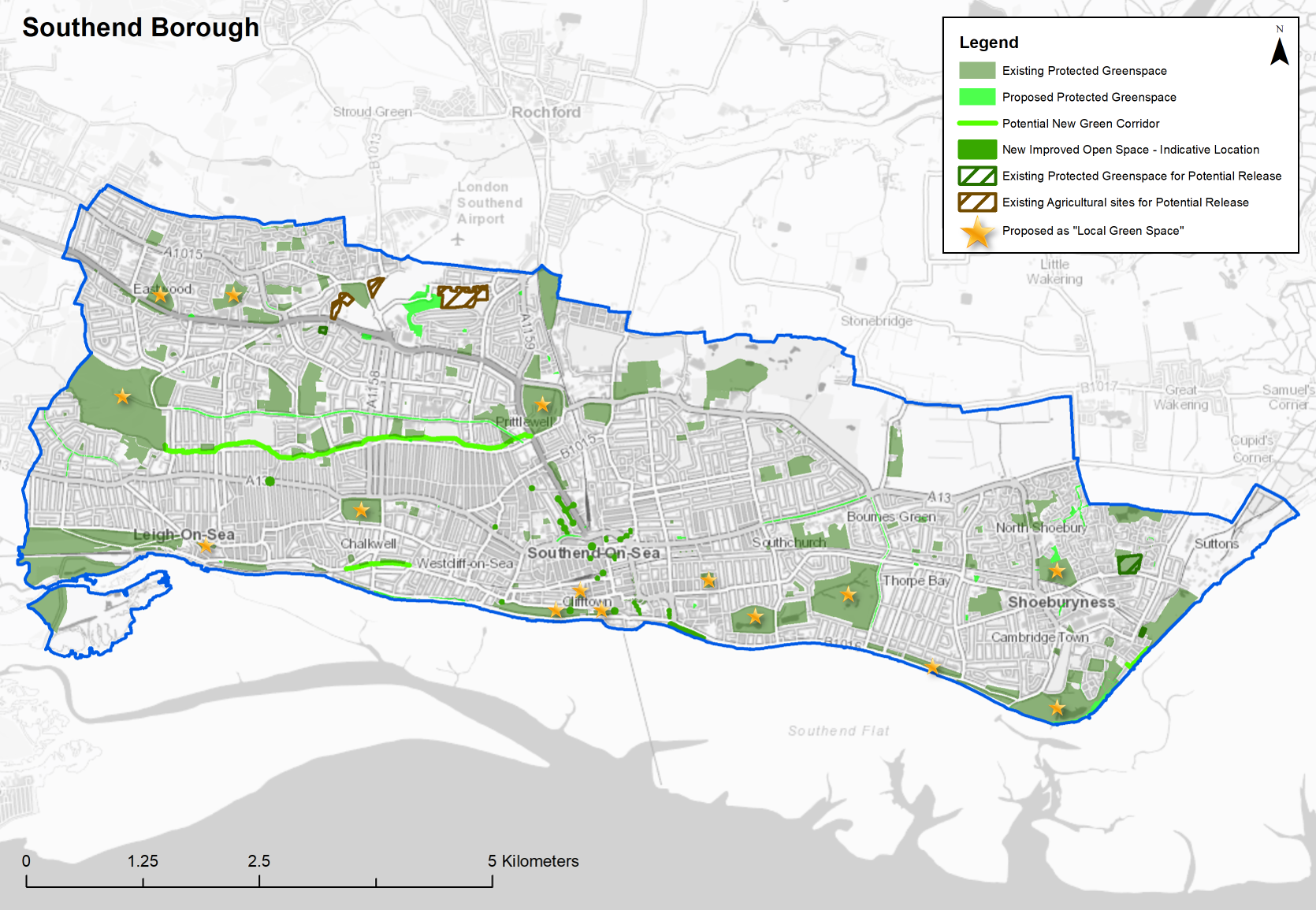
To view our mapping feature (Green Space): Southend-on-Sea Borough Council – Local Plan: Map 3 Green Spaces (opus4.co.uk)
To view our mapping feature (Urban Forms): Southend-on-Sea Borough Council – Local Plan: Map 2 Urban Forms Map (opus4.co.uk)
Appendix 1 – All new potential housing and employment sites and sites with planning permission (5 units or more)
Appendix 2 – Existing and proposed Protected Greenspace and potential release sites